

Save $11.95
25% off
The World's Best World Map

It took over five years of work, and an investment of hundreds of thousands of dollars for us to develop our first world map. To put it simply, it's The World's Best World Map

It's not a surprise that Maps of World gets millions of visitors each month...after all, it is renowned as the most Current, Credible, and Consistent network of map-related sites online.

We're using our expertise to develop what we think is the best printed map of the world available anywhere:
The World's Best World Map.
What Makes it
The World's Best
World Map?

To bring to you The World's Best World Map, we selected the best map printing company in the United States as our partner. Williams & Heintz Map Corporation is a family-owned business in Maryland that has been printing maps for entrepreneurs, government agencies and map publishers for over 92 years. They have evolved from engraving topographic maps on copper plates to production and printing of quality maps with an assortment of graphics and GIS software for projects like navigational charts for the National Oceanic and Atmospheric Administration.
Most map publishers settle for general commercial printers with no special expertise or equipment. We didn't. We partnered with Williams & Heintz. Today's complex cartography, with multiple colors, overlays and line traps require a skilled artisan with a good eye. It requires a map printing specialist to correctly balance colors and adjust registration to make the finished product as close to perfect as possible. Even the best press operator in a general commercial print house doesn't know about, say, fitting drainage to contours. Williams & Henitz does. It's all they do.

Williams & Henitz has specialized map printing equipment which is essential for high-quality maps. For example, their main presses are manufactured by Roland DG Corporation of Hamamatsu, Japan. Roland is the world's number one provider of wide-format inkjet printers, which are used only for printing maps.
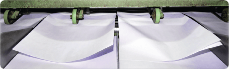
To ensure that our maps arrive in perfect condition, we have partnered with Omnimaps, which is based in Burlington, North Carolina. Although a map may seem like a detail, it is large and a somewhat fragile printed sheet of paper. For efficiently and properly packing and shipping the map, specialized expertise and packaging is required. Omnimaps is a specialist in this field and that is why we have selected it.

Like Williams & Heintz, Omnimaps specializes in maps. The company acts as official stocking agent for hundreds of government agencies from countries including Great Britain, Mexico, Russia, Switzerland, Canada and many others. They are experts in storing, packing and shipping maps and ensure that your map arrives quickly, and in perfect condition.

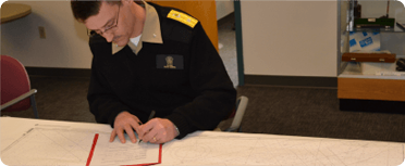
In addition to printing and fulfillment, there is the map itself. The World's Best World map has, of course, been extensively reviewed, proofread and updated by the best cartographic and mapping experts in the world; retained specifically to check, recheck and perfect our work. These include academic mapping experts from the University of Delhi, in Delhi, India, and industry mapping experts from Magna Carta Maps, of Lancaster, Pennsylvania, along with a small army of researchers and proofreaders.
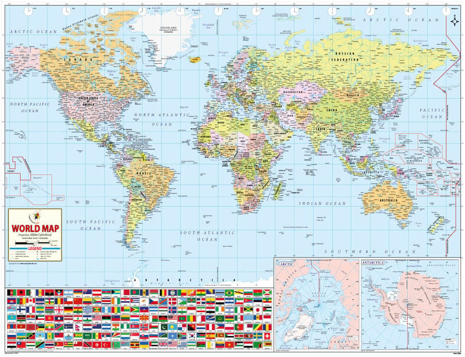
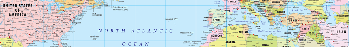
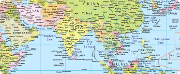
First of all, the perspective. From over a hundred different ways of visually depicting the world, we selected the Miller Cylindrical Projection. Developed in 1942, the Miller Projection represents the entire world in a rectangle without much size exaggeration and shape distortion in the high latitudes, as found in Mercator projection. Even at the Equator, the scale is true without any distortion. According to our experts, this method is the best way to accurately visually depict the world.
From that foundation, we then focused on the four key elements of a great map: design, usability, detail and comprehensiveness. What does all this really mean?
Design
A great map is a work of art - a combination of utility and aesthetics. This combination of beauty and utility is the real art of mapmaking.
A few examples from The World's Best World Map:
- As a world political map, it is highly detailed, showing all the countries with vibrant and contrasting colors for visual clarity.
- After deploying type-positioning algorithms for placing labels, our cartographers manually did extensive post-computer editing, adjusting each and every label position to ensure they are crisp, clear and, above all, attractive.
- Despite being rich in detail, the map maintains clarity and simplicity without any visual clutter, making it an excellent choice for students and youngsters.

Usability
Maps visually provide immense amounts of complex information. The most essential and basic function of map making is to organize that information so it's easy to use. In our map, we have paid a great deal of attention to this aspect. For instance:
- The international borders of Europe, the world's second smallest continent, have been shown with utmost clarity without resorting to the use of inset.
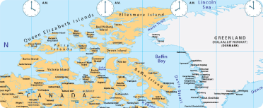
- The detailed insets of the two Poles are an added advantage for the user. The Arctic and Antarctic regions are elaborately depicted along with the research stations of different countries.
- The naming convention used for place and feature names on the map has an international English orientation to suit all kinds of users.
- The spellings of the names of places have been extensively cross-checked from a number of sources.
- Across the map, the labels are consistent and uniform, be it the city label for cities of different sizes or the island names.

- Bill Spicer
Careful attention to detail
A great map is, above all, current and accurate. The world and its boundaries change constantly, therefore, we keep updating our map to the greatest possible extent. A few examples:
- The International Dateline has been depicted accurately, including the latest changes of Samoa and Tokelau Islands moving westwards across it.
- The newly-seceded nation of South Sudan is depicted.
Comprehensiveness
A great map is complete and provides an enormous amount of information. A few examples of how we do this:
- Flags of 196 countries are depicted on the map. Users can easily find each country's flag. This adds an informative and visually appealing dimension to the map.
- Clocks of all time zones of the world are shown on top of the map.
- All the cities depicted are carefully chosen based on various parameters such as population, familiarity, popularity, historical importance and national importance.
Save $11.95
25% off
Finally, we've created the World's Best World Map at what we think is also
the world's best price: $29.95.
From the outset, our intention was to create a map that would be in millions of homes around the world. Our goal was to set the standard for world maps. This means, that no matter what it cost us to create it, it also had to be affordable. At just under $30, it is.
The World's Best World Map.
It's the map for everyone, everywhere. Only from Maps of World.
"If you would like to be a re-seller of this map, please call 408.637.0064"
