It looks like you're trying to visit our USA store, would you like to go to our UK store?
Redirect me!
[email protected]
(866) 525-2298
9 AM – 5 PM ( CDT )
My Account
Wishlist
Checkout
Login/Register
[email protected]
World Maps
Digital Map
Printed Map
USA Maps
Digital Map
Printed Map
USA State and Counties
Digital Map
Printed Map
US Zip-Code Maps
Digital Map
Printed Map
USA Cities
Digital Map
Printed Map
Search
0
Your shopping cart is empty!
0
Home
Digital Maps
Countries Maps
Slovenia
Digital Maps
US States
Kansas
Digital Map Files
›
Wall Map on Demand
›
Vinyl Maps
›
Kansas
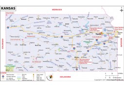
This Reference Map of Kansas, shows the major transportation routes through the ‘Sunflower State.' .....
View Details
+
CART
+
WISH
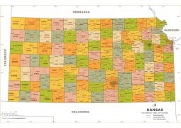
This Kansas County Map shows the state and it’s 105 counties. Each county is color codes for easy id.....
View Details
+
CART
+
WISH
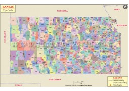
This Zip Code Map of Kansas is designed to clearly show the distribution of the USPS Zip Codes thro.....
View Details
+
CART
+
WISH
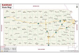
Kansas Map .....
View Details
+
CART
+
WISH
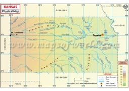
Physical Map of KansasSize of the map : 72 DPI file is 1200 Pixel wide and 300 DPI file is 3338 Pixe.....
View Details
+
CART
+
WISH
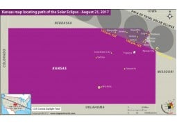
.....
View Details
+
CART
+
WISH
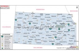
Map of Kansas National Parks .....
View Details
+
CART
+
WISH
Designed by internationally renowned cartographer, Nat Case, and with an eye towards the business u.....
View Details
+
CART
+
WISH
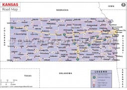
Kansas Road Map .....
View Details
+
CART
+
WISH
Kansas River Map .....
View Details
+
CART
+
WISH
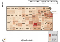
Kansas Population Estimate By County 2016 MapSize of the map : 72 DPI file is 1200 Pixel wide and 30.....
View Details
+
CART
+
WISH
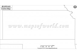
Kansas Outline Map .....
View Details
+
CART
+
WISH
.....
View Details
+
CART
+
WISH
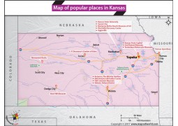
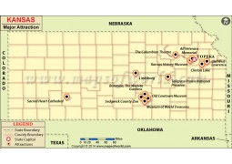
Kansas Major Attraction Map .....
View Details
+
CART
+
WISH
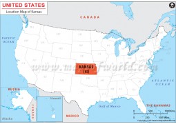
Kansas Location Map .....
View Details
+
CART
+
WISH
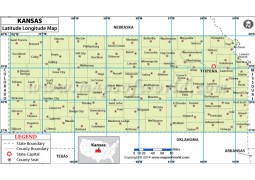
Kansas Latitude Longitude Map .....
View Details
+
CART
+
WISH
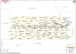
Kansas Cities Map .....
View Details
+
CART
+
WISH
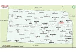
Kansas Airports Map .....
View Details
+
CART
+
WISH
Showing 1 to 18 of 18 (1 Pages)

 $25.00